Related
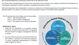
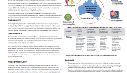
The recently developed UN‐level Comprehensive School Safety (CSS) framework (UNESCO/UNICEF, 2014) provides a detailed and coordinated approach to reducing all hazard risks to the education sector. The CSS provides a guiding framework that can be customised to the Australian school setting to facilitate the development of a participatory approach to bushfire emergency management planning in schools.
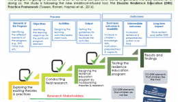
This study aims to design and test a disaster resilience education program for children within the framework of participatory action research paradigm aligning with a child-centred disaster risk reduction (CC-DRR) ethos using bottom-up and top-down design strategies.
This project focused on the evaluation of communication strategies and identification of barriers and enablers to residents’ preparedness for bushfires and floods.
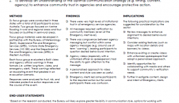
“Based on the research conducted, the Bureau will likely explore greater flexibility in communication style, options for working with media and other agencies to incorporate visual footage (particularly television), and the possibility of interactions between multiagency and media messages. The Bureau is appreciative of the opportunity to work closely with QUT researchers in better understanding community responsiveness to our warnings communications and to provide guidance for enhancing our services to the community.” – Bureau of Meteorology
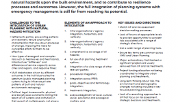
Urban Planning – UP systems have considerable potential to modify the impacts of natural hazards upon the built environment, and to contribute to resilience processes and outcomes. However, the full integration of planning systems with emergency management is still far from reaching its potential.
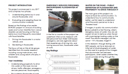
If imagery in public risk communication always presents a fast flowing, clearly dangerous body of water, how do we expect drivers to behave when faced with more benign-looking water on the road?
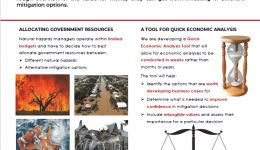
In order to help natural hazards managers with the prioritisation of mitigation options and the efficient allocation of resources, we are developing a Quick Economic Analysis Tool that will provide natural hazards managers with a quick and rough overview of the value for money they can get from investing in different mitigation options.
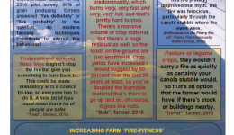
"Firebreaks and spraying fence lines mightn’t stop the fire but give you something to burn back to. This could be made mandatory with a council by-law, so everyone has to do it. A little bit of loss could mean that a lot of people are safer." - Paul (farmer) 2015
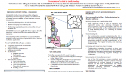
UNHaRMED (Unified Natural Hazard Risk Mitigation Exploratory Decision support system) is an interactive modelling platform helping to assist decision making, focussed on improving thinking about risk into the future; better managing and reducing risk; and positioning organisations and communities to best achieve this.
Challenges and solutions for natural hazard risk-based policy development in New Zealand interrelate within a complex system or knot, where many of the solutions are inhibited by the challenges. We explore the use of causal loop diagrams as a tool to unravel this complex system to better enable decision-makers to develop risk based policy.
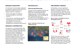
We explore the impact of the most destructive bushfire disaster ever to hit Australia on the disaster-hit individuals’ economic resilience. By analysing Australian 2006 and 2011 Census data, we determine whether their income levels were able to recover post disaster, considering demographic factors and sectors of employment.
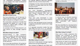
The project is providing practical techniques and strategies to help people function in more complex EM environments now and into the future. Throughout the project, there has been significant consultation with end users. End Users have trailed the tools being developed and found them to be useful. A number of agencies are implementing the tools in a variety of settings include real time evaluations, debriefs, exercising and individual use by IMT members.
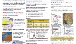
The primary focus of this study is an improved methodology for quantifying the flood risk. The outcome is substantial for decision-makers dealing with flood risk management for prioritisation of risk mitigation options and choosing best practice.
Flood driving fatalities are on the rise despite appeals to the general public. While much is known about the demography of flood driving fatalities, less is known about the psychological mechanisms of flood driving behaviour and how this might be used to influence behaviour change.
Disaster resilience policy is being implemented via a range of programs and activities across Australia - effective implementation is critical for ensuring successful outcomes.
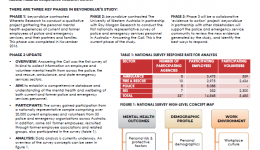
beyondblue is undertaking the National Mental Health and Wellbeing Study of Police and Emergency Services to build a comprehensive picture of the mental health and wellbeing of police and emergency services personnel in Australia. The beyondblue National Mental Health and Wellbeing Study of Police and Emergency Services is supported by the Bushfire and Natural Hazards Cooperative Research Centre.
The Policies, Institutions and Governance (PIGs) in Natural Disasters project recommended finding a new way to conduct post event inquiries.
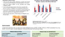
This study aimed to identify the prevalence and predictors of post-traumatic stress disorder (PTSD), depression, anxiety and alcohol misuse in firefighters. Predictor variables included exposure to potentially traumatic events (PTEs) as well as individual, operational and organisational factors.
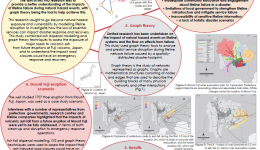
How prepared are we for extensive lifeline failure, and can graph theory aid in disaster mitigation?
The context in which Emergency Management Organisations (EMOs) work is changing due to social, environmental and economic factors. This is driving transformation across the sector as it strives to work with and build resilience and be representative of their diverse communities. This means that effective diversity and inclusion (D&I) is a business imperative needed to sustain EMOs into the future.
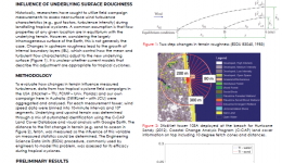
Using wind observations from three tropical cyclone field campaigns, an analysis of near-surface turbulence is undertaken. With towers deployed in a variety of terrain exposures, preliminary results show turbulent parameters to be highly dependent on upstream terrain conditions. ‘Memory’ of these conditions can remain in the flow for many kilometres downwind a surface adjustment.
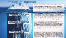
We asked 26 government and non-government volunteer managers about volunteer sustainability. You might be surprised by what they told us. Recruitment and retention practices are just the tip of the iceberg when it comes to the changes needed to meet the future.
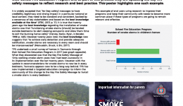
Tasmanian Fire Service are undergoing a rigorous process of evaluating their School Fire Education Program and, as part of this process, are updating key fire safety messages to reflect research and best practice.
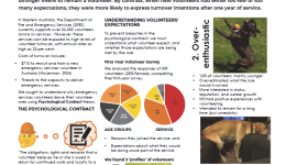
In this study, we examined how meeting the initial expectations of new volunteers when they join an emergency service is related to their intentions to remain with that service. A survey of 539 emergency services volunteers revealed that the new volunteers whose expectations matched what the volunteering role could deliver tended to participate in more volunteer activities and had a stronger intent to remain a volunteer. By contrast, when new volunteers had either too few or too many expectations, they were more likely to express turnover intentions after one year of service.
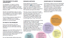
The NSW Geography Syllabus requires that all Stage 3 students (Years 5 and 6) in New South Wales study the effect of a contemporary bush fire event on people, place and the environment – approximately 100,000 students in 4,000 classrooms across 2,500 schools doing this Unit of Work each year.
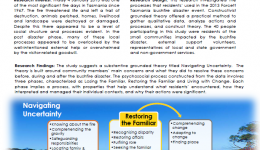
Friday 4 January 2013 was one of the most significant fire days in Tasmania since 1967. The fire threatened life and left a trail of destruction, animals perished, homes, livelihood and landscape were destroyed or damaged. Despite this there appeared to be a level of social structure and processes evident. In the post disaster phase, many of these local processes appeared to be overlooked by the well-intentioned external help or overwhelmed by the visitor - related goodwill.
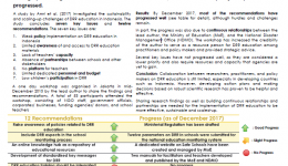
The Sendai Framework on Disaster Risk Reduction (DRR) stresses the importance of collaboration between researchers, practitioners, and policy makers. However, little evidence of such collaboration exists in developing countries, including in Indonesia. In December 2015, we presented the findings to key government agencies, NGOs and academics, from a study investigating the sustainability and scaling-up challenges of DRR education in Indonesia. In 2017, we assessed how policy and practice have progressed.
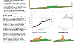
Can a physics-based model predict a transition from a surface fire to a crown fire?
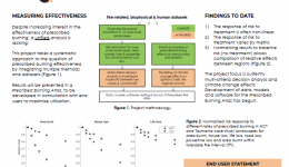
How does the diverse and changing biophysical, climatic and human context of southern Australia influence prescribed burning effectiveness?
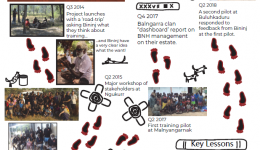
The ‘BNH Training for Remote Communities’ was initially perceived as training for ranger group members. But as time went by and the participation of Bininj became more embedded, the focus shifted to ’resilience’ training for whole communities.
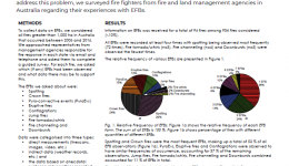
Extreme fire behaviours (EFBs) are phenomena that occur within intense fires that have been shown to contribute greatly to their to impacts. However, there exists little understanding regarding how often particular EFBs occur, how these contribute to fire behaviour and what importance should be allocated to each in the development of models for decision support. To address this problem, we surveyed fire fighters from fire and land management agencies in Australia regarding their experiences with EFBs.
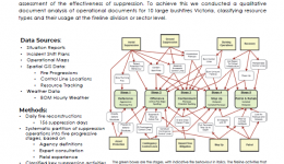
Large bushfires (over 500ha) account for a disproportionate amount of both hectares burned and suppression expenditure; however, the effectiveness of large-fire suppression is poorly understood. The aim of this study was to provide a framework for the development of an overall assessment of the effectiveness of suppression. To achieve this we conducted a qualitative document analysis of operational documents for 10 large bushfires Victoria, classifying resource types and their usage at the fireline division or sector level.
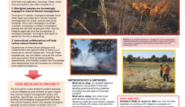
This innovative 3-year research project explores cultural difference and similarity to gain insights into natural hazard management policy and practice. Specifically investigating the existing and emerging engagements between the natural hazards sector and diverse Aboriginal peoples across southern Australia. This is an intercultural project for an intercultural society.
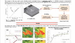
We propose an index for continuous monitoring of forested areas. It is based on the free of charge Landsat satellite imagery. The index allows the creation of fuel load maps and the reconstruction of post fire fuel re-accumulation curves.
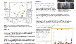
Australian tall wet eucalypt-dominated forests are widely considered to experience a fire regime of infrequent, high-severity, stand-replacing crown fires. Yet, this paradigm ignores the possibility of low- and mixed-severity fires in these ecosystems. We analyse fuels from a network of long-term monitoring plots that span the continent to investigate the fire regime of tall wet eucalypt forests.
The Bushfires and Natural Hazards CRC is supporting the investigation of Indigenous driven interests and initiatives in building community resilience as a foundation for more effective relationships with Emergency Management agencies. Indigenous culture and society is central to the future development of North Australia. Although the physical assets are easily recognised – land and sea, pristine environments, biodiversity, minerals, fishing resources, places for tourism etc.
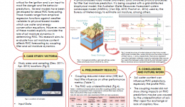
This research aims to evaluate the role of soil moisture in determining dead fuel moisture content by coupling litter and soil moisture dynamics.
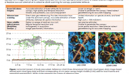
This PHD research aims to develop and assess methods using stereo imagery and laser scanning data, to extract 3D tree structural parameters for estimating biomass/carbon stocks in NT mesic savannas.
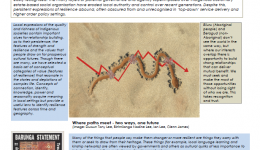
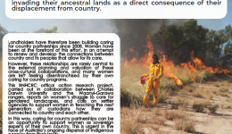
In the remote southwest Gulf of Carpentaria, Waanyi and Garawa peoples have been experiencing destructive wildfires invading their ancestral lands as a direct consequence of their displacement from country.
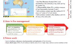
"The new technology described here has enormous potential to improve the efficiency of bushfire operations across Australia and drive an expansion of our capability. The provision of accurate, spatially explicit, near real-time estimates of FMC and flammability at a range of spatial resolutions would permit more accurate targeting of scarce bushfire fighting resources in time and space. It would no longer be necessary to estimate jurisdiction-wide readiness based on anecdotal extrapolation of conditions at a few locations." Adam Leavesley, ACT Parks and Conservation Service
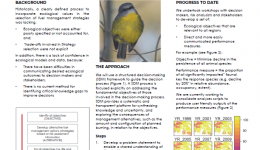
This project aims to develop a consolidated and flexible framework for applying ecological models and metrics to manage risks to ecosystem resilience and threatened species to facilitate effective decision making.
“The outcomes from this research will provide information for us to use remotely sensed data to improve our flood forecasting service. This work will support the development of both probabilistic flood forecasts, and flood forecasts that provide much more detailed information on the impact of floods.” – Chris Leahy (Australian Bureau of Meteorology)
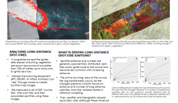
Bushfires can ignite spot-fires at very long distances downwind. The number and maximum distance of spot-fires are not necessarily correlated, and can vary widely between bushfires. Bushfire observations from infrared aerial mapping collected by fire agencies helps to understand the processes and quantify the risk factors.
The resource capacities of emergency management organisations are geared around managing relatively frequent disaster scenarios. It is not cost effective to have significant investments of resources that might be only employed in the most extreme or catastrophic events. However, the inevitability of more extreme events that can overwhelm local and regional, and even national, resources means that it is worth considering where additional surge capacity might be sourced if and when needed.
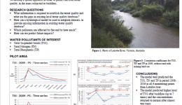
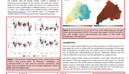
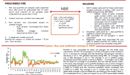
In this research the impact of bushfires on Total Suspended Solids (TSS), Total Nitrogen (TN) and Total Phosphorus (TP) in Latrobe catchment was predicted, for 2008-2016. The hydrological model applied (eWater Source), found higher levels of pollution after bushfires followed by rain, in accordance to the measured values, in the 6 monitoring points from Latrobe river, which were considered for this research. However, the model overestimated the pollution levels. At this stage, a new land use (mining) was introduced in the model and the results were much improved.
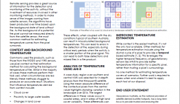
Satellite remote sensing provides a timely and efficient method of detecting fire, but choosing the right parameters to encompass all potential fire activity is difficult. Variations in sample area conditions, such as coastline, cloud and land cover can impact the ability to correctly detect and attribute fires in the environment.
Vehicle-related flood fatalities and rescues are a significant emergency management and road safety problem. Motorists may enter floodwater that is too deep or too fast, or may attempt to drive along roads that have been
washed away. Gissing et al. (2017) investigated the influence of road characteristics on flood fatalities based on a site analysis of 21 road sections where fatalities had occurred.
Future sea level rise will exacerbate coastal flooding globally. Adaptation pathways provide a dynamic plan under conditions of uncertainty to take short-term actions, whilst keeping future options open to make adjustments as conditions change.
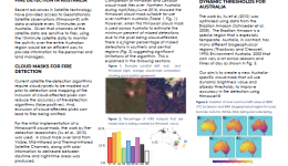
Recent advances in remote sensing have led to geostationary satellite data being available over Australia every 10 minutes. For frequent and accurate detection of fires from geostationary satellite data, and their assessment, a high-quality satellite cloud mask for Australian environments is required.
It is important to consider how future catastrophic disasters might be shaped by choices we make as a society to various political, economic and environmental alternatives along with technological advances. We have explored these influences through a series of short interviews with emergency management leaders and a review of relevant literature. The research seeks to provide some strategic foresight that may assist in the
development of strategic plans to minimize the consequences of future risks.
The UWA/BNHCRC project has developed a high-resolution hydrodynamic model for all Australia that was used to simulate sea levels at 1 km resolution over the past 59 years. Extreme value theory was applied to these data to derive sea level statistics, including 100 year Average Recurrence Intervals (ARI), and ARI (Return Period) curves. The results have been made available to the public through an interactive web portal where you can access detailed extreme sea level information for every beach in Australia.
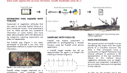
Fuels3D is a smart-phone app coupled with photogrammetry and computer vision techniques to produce 3D point clouds of the environment from which fuel hazard metrics are derived. Fuels3D supplements existing visual assessments with repeatable and quantitative estimates of surface and near-surface fuel. Trials are currently underway with end-user agencies across Victoria, South Australia and ACT.
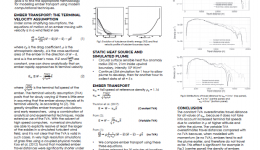
Spotting is a challenging aspect of bushfire operations. We currently have poor capacity to estimate exactly how far ahead of a fire a spot fire could form. This research is providing insight into this problem by helping us understand the dynamic effects that can influence ember transport. This will help emergency response during major bushfires. - Brad Davies, NSW RFS
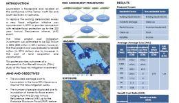
This poster provides outcomes of a retrospective Cost Benefit Analysis (CBA) study of a flood risk mitigation investment (levee system) in Launceston. The study assessed the long term cost to Launceston from flood hazard before and after the new mitigation works for flood events ranging from the 20 year Annual Recurrence Interval (ARI) up to the Probable Maximum Flood (PMF).
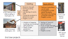
This project will address the need for an evidence base to inform decision making on the mitigation of the risk posed by the most vulnerable Australian buildings subject to earthquakes. Simultaneous progress is being made by the 4 partner investigators to assess the vulnerability of two classes of existing buildings.
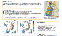
One of the most significant thunderstorm outbreaks recorded in South Australia impacted central and eastern parts of the state on 28 September 2016. Multiple supercell thunderstorms produced at least seven tornadoes, destructive wind gusts, large hail and intense rainfall. Transmission lines were brought down in four different locations, which contributed to a state-wide power outage.
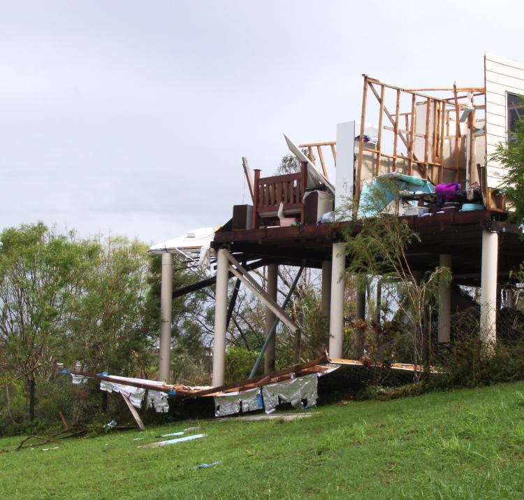
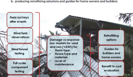
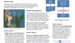
This project aims to investigate and reduce damage from windstorms by developing vulnerability models for structural strength of housing from field and laboratory observations to allow evaluation of cost effective strategies, and producing retrofitting solutions and guides for home owners and builders.
Developing a pilot capability to estimate the impacts of East Coast Low hazards on the built environment, enabling more timely mitigation action by a range of stakeholders.
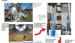
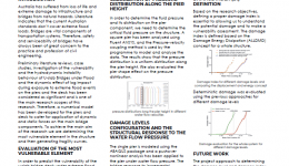
Progressive or cascading failures of roofing connections were simulated using a computer model based on wind tunnel data, dynamic connection tests and damage surveys observations. Results identify the most vulnerable parts of the roof and how damage can spread during a storm, which is essential for developing retrofitting measures for older houses.
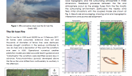
ACCESS-Fire couples an empirical fire spread model to the Australian numerical weather prediction model. The coupled model captures the dynamical interactions between a fire, local topography and the surrounding atmosphere in three dimensions.
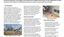
Destructive winds are inevitable around Australia and the world, thus our buildings must be prepared to withstand their damaging effects. A common and seemingly small failure of a door or window often contributes to the failure of the whole building due to wind entering, generating large internal pressures. These pressures can contribute to more than half of the total load on structural elements. This project will provide much needed information of the magnitude of these pressures with respect to building parameters to improve internal pressure design.
The present study discuss the development and evaluation of a new soil dryness product based on an advanced land surface modelling system.
Resistance to flood loading are critical parameter affecting the design of bridges under flood loading. Since the flood intensity is raising due to global warming, it is recommended to review the design of the
bridges under flood loading. Historical data show that flood as a natural hazard is a costly disaster in Australia. Resilience of society depends on the resilience of the road infrastructures.
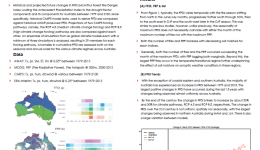
The frequency of extreme events such as heatwaves are expected to increase due to the effect of climate change, particularly in semi-arid regions such as areas of Australia. Extreme temperatures and deficits in soil moisture provide ample conditions for bushfires. This study investigates these associations both past, present and future.
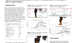
The focus of this research is to assess the performance of a steel plate girder bridge subjected to WUI fire events. Fire scenarios were modelled with physics based Fire Dynamic Simulation(FDS). Sequentially coupled heat transfer analysis gave the temperature distribution of the bridge. 12mm Web area experienced the highest temperature development of 350C . This leads to a 25% of decrease of steel Youngs modulus.
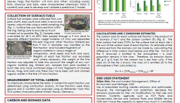
"Use of prescribed burning creates emissions and particulates. However, fire management can potentially decrease the emissions produced by fires via modifications to their size and intensity. Currently, agencies such as ACT Parks and Conservation Service and National Parks and Wildlife Service NSW don’t have the capacity to report how much C is emitted from their prescribed burning programs. With the recent public focus on air quality, the ability to estimate C emissions it is vital for management agencies.
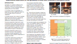
The propagation of fire inside a typical forest canopy is heavily dependent on the amount of oxygen present during the fire propagation, fire intensity, and ignitability of surface fuels which is generally composed of forest litter, shrubs, etc. In eucalyptus vegetation the forest litter predominantly contains eucalyptus leaves, twigs, and bark. The present work discusses experimental observation for the ignitability of forest litter composed of eucalyptus leaves.
"Biomass burning is one of the main causes of carbon loss in the soil and could lead to increased erosion and runoff. SWAT models can be used to predict long-term impact of land use change on catchment flow and water quality as well as testing “what-if” scenarios. Fire in water catchments needs to be dealt with on a case-by-case basis so land managers can chose the best options to increase the mass of carbon in soil and retain water in the system.
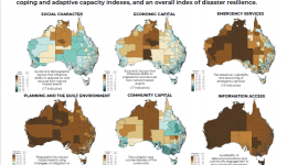
The Australian Natural Disaster Resilience Index will assess and report the resilience of Australian communities to natural hazards. Assessment of disaster resilience is based on eight themes that encapsulate the influences on disaster resilience. The index results for the eight themes are presented here. Further work will compute coping and adaptive capacity indexes, and an overall index of disaster resilience.

