Dr Imtiaz Dharssi

Researcher
About
Dr Imtiaz Dharssi

Imtiaz Dharssi is a Land Surface Data Assimilation Scientist at Centre for Australian Weather and Climate Research, having previously worked for The Met Office in the UK for over 11 years. Hi reserach interests include:

  • Assimilation of satellite derived soil moisture
  • The Unified Model soil moisture nudging scheme
  • Parametrization of the soil physical properties
  • High-resolution soil texture maps for the Unified Model

Project leadership

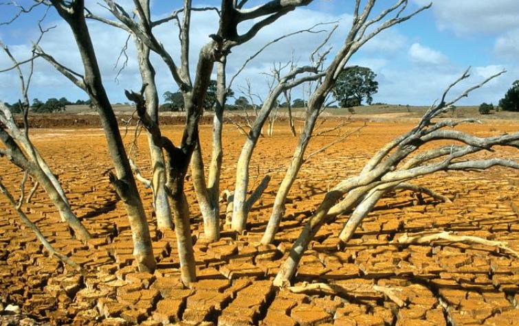
This project examined the use of detailed land surface models, satellite measurements and ground-based observations for the monitoring and prediction of landscape dryness. The research team developed a standalone prototype land surface modelling system, called Joint UK Land Environment Simulator based Australian Soil Moisture Information (JASMIN) to produce daily soil moisture analyses at 5km resolution and 4 soil layers. Verification against ground-based soil moisture observations shows that this prototype system is significantly more skilful than both the Keetch–Byram Drought Index and Soil Dryness Index. This project also aimed to improve applications such as fire danger mapping that may require soil moisture information at higher spatial resolution due to the large spatial variability of soil moisture in the landscape, and developed a simple yet skilful model to predict live fuel moisture content for the whole of Australia.
A new soil dryness product for fire prediction applications
19 Sep 2018
The present study discuss the development and evaluation of a new soil dryness product based on an...
Investigating the effect of soil moisture, temperature and precipitation extremes on fires risk and intensity in Australia
19 Sep 2018
The frequency of extreme events such as heatwaves are expected to increase due to the effect of...
Improved measures and forecasts of soil dryness
29 Jun 2017
New approaches are available to calculate soil dryness more accurately through the use of satellite...
Alex Holmes Conference Poster 2016
14 Aug 2016
Extreme temperature and deficits in soil moisture provide ample conditions for bushfires.
Vinod Kumar Conference Poster 2016
14 Aug 2016
Soil dryness is a key component in operational fire danger rating systems.
Improving Fire Risk Estimation through Investigating Fire Intensity, Moisture and Temperature Anomalies
18 Aug 2015
The accuracy of FDI's are largely dependent on their input variables and advancements in remote...
Sources of Soil Dryness Measures and Forecasts
18 Aug 2015
Emerging new approaches to evaluate landscape dryness through the use of satellite remote sensing...
Towards the Assimilation of AMSR2 Soil Moisture and Vegetation Data for Natural Hazard Monitoring and Prediction
18 Aug 2015
This project aims to improve the estimation of landscape moisture through the assimilation of AMSR2...
Mitigating the effects of severe fires, floods and heatwaves through the improvements of land dryness measures and forecasts
25 Aug 2014
This project will improve Australia’s ability to manage extreme events by developing a state of the...

Resources credited

Type Released Title Download Key Topics
Presentation-Slideshow 17 Oct 2019 Mitigating the effects of severe fires, floods and heatwaves through the improvements of land dryness measures and forecasts PDF icon Save (1.41 MB) forecasting, land management
Presentation-Slideshow 27 Aug 2019 JASMIN: A high-resolution soil moisture analysis for fire prediction PDF icon Save (2.15 MB) fire, flood
Presentation-Slideshow 19 Sep 2018 Evaluation and calibration of a land surface model based soil moisture analysis for fire prediction PDF icon Save (3.08 MB) soil moisture
Presentation-Slideshow 31 Oct 2017 Mitigating the effect of severe fires, floods and heatwaves through improvements to land dryness measures and forecasts PDF icon Save (1.38 MB) forecasting, land management, mitigation
HazardNoteEdition 14 Jun 2017 Soil moisture prototype improves forecasts PDF icon Save (186.47 KB) forecasting, land management, soil moisture
Presentation-Slideshow 18 May 2017 Towards an improved land dryness estimate for fire prediction PDF icon Save (5.71 MB) fire, flood, remote sensing
HazardNoteEdition 28 Nov 2016 Monitoring and predicting natural hazards PDF icon Save (853.18 KB) forecasting, modelling, severe weather
Presentation-Slideshow 24 Oct 2016 Mitigating the effects of sever fires, floods and heatwaves through improvement to land dryness measures and forecasts PDF icon Save (3.12 MB) fire, flood, forecasting
Presentation-Slideshow 30 Aug 2016 A high resolution land dryness analysis system for Australia - Imtiaz Dharssi PDF icon Save (3.93 MB) fire weather, flood, severe weather
Presentation-Slideshow 11 Sep 2015 Verification of soil moisture from multiple sources for bushfire danger rating applications PDF icon Save (3.33 MB) fire impacts, soil moisture
Presentation-Slideshow 26 Jun 2015 Verification of Soil Moisture from Multiple Models for Bushfire Danger Rating Applications PDF icon Save (4.32 MB) fire, flood, remote sensing
Presentation-Slideshow 05 Dec 2014 Mitigating the effects of severe hazards PDF icon Save (1.99 MB) forecasting, modelling, soil moisture
Presentation-Audio-Video 27 Oct 2014 Mitigating the effects of severe fires, floods and heatwaves fire, flood, forecasting
Presentation-Slideshow 08 Sep 2014 Mitigating the effects of severe fires, floods and heatwaves PDF icon Save (1.7 MB) fire, flood, forecasting
Presentation-Slideshow 21 Mar 2014 Monitoring and prediction PDF icon Save (7.35 MB) flood, modelling, multi-hazard

Send a message to Dr Imtiaz Dharssi (via CRC)

User Contact