2015 Adelaide annual conference
img_0074_1.jpg

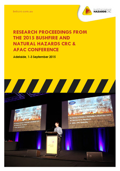
More than 1500 people heard the latest in natural hazards science at our annual conference and Research Forum in Adelaide (1-3 September 2015).
The Research Forum encourages intensive discussion and interaction among the delegates. The day was not just for scientists - it was a great opportunity for emergency management personnel and end users to learn about the current research and connect with researchers.
Many more Bushfire and Natural Hazards CRC researchers spoke on the main conference program on the Wednesday and Thursday, complemented by agency and industry speakers. In total, the week saw almost 100 presentations, along with six personal development programs and field trips.
The delegates discussed the latest challenges and trends in emergency management at the region’s major all hazards conference.
The Australasian Fire and Emergency Service Authorities Council (AFAC) and Bushfire & Natural Hazards CRC annual conference featured leading national and international speakers over four days under the theme New Directions in Emergency Management.
Download Conference Proceedings
PDF Version: The Proccedings have been published in a PDF for reference and citation and are available from the CRC publications collection.
Online Versions: All the speaker slides, extended abstracts, and more than 100 posters are available to download through the [tabs] on this page below.
Conference website: For copies of the program or other conference materials, please visit the conference website.
Venue
Event Type
Images


Related


 launches the 2015 program")

This research monitors changes in understorey fuel hazards for up to 2 years post-burn using terrestrial laser scanning. This provides quantitative estimates of fire impact on the landscape including immediate fire effects, post-burn fuel accumulation and prescribed burn effectiveness.

Integration of bushfire and planned burn ignition and fire history datasets.
 for Official Emergency Management (OEM)")
VGI refers to the creation and sharing of geographic information by community members, mainly through social media, smartphones and online mapping tools. VGI represents a shift in the ways information is created, shared, used and experienced. Detailed interviews with 13 emergency management professionals from 8 organisations across 5 Australian states provided insights into the impacts of VGI on OEM.

Organisations increasingly find themselves responding to unprecedented natural disasters that are expereinced as complex, unpredictable, and harmful. This study examines how organisations understood and learned from these novel experiences by examining three Australian bushfires. My study shows how sensemaking and learning occurred during public inquires that followed these events, and how learning continued in emergency management organisations.

Children represent the most vulnerable demographic group in disasters. The world health organisation estimates that 30-50% of disaster fatalities are children. They are also most vulnerable to psychosocial impacts. However, preliminary research and the new Sendai Framework also identifies them as community “drivers” of change for reducing current and future disaster risks and increasing community resilience.

Resilient communities are better able to anticipate hazards, withstand adversity, reduce losses and recover From natural hazard events. The Australian natural disaster resilience index is a system of indicators that WILL assess and report the resilience of Australian communities to natural hazards.

What-if a magnitude 6.0 earthquake happened near Adelaide SA? IN this project we have developed such scenario by using Risk Frontiers earthquake loss model QuakeAUS to calculate losses to property, infrastructure and casualties.

Active fires are inscreasingly being identified using satellite remote sensing to determine their size and severity. Verifying the information derived from the wide variety of different sensors and their associated fire algorithms can be a challenging task.

This Project aims to provide enhanced ways of:
- Making decisions in complex situations
- Monitoring teams to detect problems
- Learning from operational performance

Smoulder is a type of slow, low-temperature combustion of relevance to bushfires. It occurs both in pre-fire and post-fire stages. Many fires are caused by smouldering fire; once ignited, smouldering often lasts for days or weeks and can turn into flaming combustion.

Culturally appropriate frameworks for Bushfire and Natural Hazards management are critical to establishing resilience in remote Indigenous communities. A Collaboration with the Waanyi and garawa people of the south-west Gulf of Carpentaria is an opportunity to develop a regional case study.

Although many jurisdictions are committed to prescribed burning, we do not understand its effects on risks to people, property and environmental values across Australia.

Encouraging insurers to share and communicate bushfire risk with policy holders.

Building on the evaluation of risk: incorporating the evolution of hazard risk over time with dynamic modelling of exposure.

This project aims to investigate which individual, operational and organisational factors contribute most to the wellbeing of career and volunteer firefighters.

In the last decade A range of sensing technologies, techniques and platforms have emerged to capture 3D structural information. This project explores these systems as alternative quantitative solutions to traditional fuel hazard and fire severity evaluations.

The focus of this research is to assess the performance of existing reinforced conrete (RC) wall and core buildings in response to a rare or very rare earthquake event in Australia. Ultimately, fragility functions for different performance objectives will be derived and cost-effective detailing provisions will be recommended.

Our aim is to examine evidence-based strategies to motivate appropriate action and increase informed decision-making during the response and recovery phases of disasters. We combine expertise in communication, consumer psychology and marketing, disaster and emergency management, and law.

Flooding is Australia's most expensive natural hazard. Climate change scenarios predict increasing flood intensity and frequency. This potentially exposes Australia to greater damages in the future, making flood management key to improving adaptive capacity. This research explores whether ‘resilience’ strategies will result in outcomes that are truly adaptive.

This project seeks to determine what type and level of suppression resources are required for successful containment of campaign fires under a given set of fire weather, fuel, and topographic conditions.

There are high public expectations for warning and risk communication during emergencies, they include the expectation that social media will be adopted. Yet the extent of the legal requirement to warn and use social media is uncertain? Equally in utilising social media to push and pull information, legal issues can arise? This thesis investigates some of the issues.

Understanding the variability of wind speed and direction across complex terrain is a vital part of understanding volatile fire behaviour. A probabilistic characterisation of wind fields can complement the current deterministic approaches to enhance discussion of uncertainties in the modelling process.

Large-eddy simulations of bushfire plumes are combined with firebrand trajectory calculations to estimate the effects of in-plume turbulence on firebrand transport. In-plume turbulence substantially lengthens the maximum spotting distance AND increases the lateral and longitudinal spread of firebrand landing positions.

Accurate, timely and precise forecast precipitation is the "Holy Grail" of flood forecasting; this project aims to use observation constrained hydrologic models to estimate precipitation.

Bushfires and natural hazards are a dynamic risk where risk levels are unpredictable and more likely to change or fluctuate quickly. They are also often systemic and can result in unanticipated outcoms. Communication in this area is crucial and is only effective if it is based upon a broader understanding of how people respond to dynamic risk and why.

Emerging new approaches to evaluate landscape dryness through the use of satellite remote sensing data, land surface modelling and data assimilation techniques are available, measuring dryness more systematically than the empirical methods. Satellite measurements can be blended with land surface model simulations to provide more accurate, detailed and confident estimates and forecasts of land dryness.

A tsunami generated by an earthquake within the Hikurangi Subduction Margin is probably a candidate for the most destructive tsunami New Zealand is to encounter. And this is not New Zealand’s risk alone; destructive tsunamis of this scale are also a major risk to Australia’s coast. However surveys have shown that understanding of tsunami risk and correct warning-response action is limited, and that there is a considerable distance to go to ensure adequate awareness and preparedness of individuals and communities.

Modelling wind direction can be recast in probabilistic terms using wind response distributions. The impacts of vegetation regrowth on wind direction response can then be investigated using statistical comparison techniques.

The primary option available to reduce fire risks to the community and the environment is through a modification of fuel availability (e.g. fuel reduction burnings). The development of accurate and reliable methods to quantify forest fuel characteristics and to understand forest fuel change over time is an ongoing requirement of government, fire authorities and land management agencies. LiDAR is proposed to measure landscape-scale forest fuels in order to generate a time effective, feasible and objective method for forest fuel hazard assessment.

Nearly one third of the world's population are children. However, much disaster management programming sees children as passive participants, leaving them out of the planning and decision making process.

The occurrence of extreme water levels can lead to loss of life and damage to coastal infrastructure. To better prepare, coastal engineers, emergency managers and planners require accurate estimates of extreme water levels.

In two studies amongst residents of bushfire and flood prone areas we examined whether residents who actively use brochures, websites, and/or go to community information sessions to prepare, end up preparing more than those who do not use these sources. The studies supported this, but also showed that the majority of the sample did not use any information sources to prepare for bushfires and floods.

Optimisation of prescribed burning requires a strong understanding of the underlying variability of fuel, vegetation and soil.

The purpose of this study is to develop best practice methods for preparedness and response practices in a bushfire hazard, with the aim of enhancing community well-being and safety. Effective collaboration between animal owners, emergency responders and the whole of community could be one way to narrow the gap between hazard awareness and hazard survival.

Flood forecasts suffer from various SOURCES of uncertainties. This project investigates the benefit of using remotely sensed soil moisture data for hydrological model calibration and updating. A real-time forecasting system constrained by soil moisture and flow data is being developed.

Floods are the second highest cause of death from natural hazard events in Australia following extreme heat. Bushfire and Natural Hazard CRC research has so far uncovered 1874 flood fatalities between 1900-2015. This data shows a growing number of fatalities associated with vehicles entering floodwaters, particularly 4WDs.

How can we get the best value for money from public investments in natural hazard management? This project integrates technical, biophysical, socioeconomic and policy information to address key decision problems relating to natural hazard prevention and mitigation.

This project develops BNH Training built on learnings from BNHCRC research and tailored to North Australian needs. It employs a didactic approach to build understanding of differing world views about fire and emergency management. Its delivery mode is designed to increase levels of competence, confidence and resilience, particularly in remote regions.

What if a category 4 tropical cyclone impacted south east Queensland? What would the impacts be? Could our emergency services cope? strong cyclones have come close to the densely populated south east of Queensland, but impacts have been limited. this will not always be the case. This project explores the impacts of a severe tropical cyclone on the region and asks, can these impacts be forecast?

Statistical analyses shows the considerable impacts of flood risk compared to other types of natural hazards. In recent decades, the flood risk due to climate change and the growth in value and vulnerability of exposed properties has been increasing exponentially. The research proposed in this project will focus on quantifying the flood risks and performing a flood damage assessment for a case study area within Australia

This project aims to improve the estimation of landscape moisture through the assimilation of AMSR2 derived near surface soil moisture and vegetation moisture content. Prior to assimilation, the AMSR2 observations must be quality controlled and bias corrected. The first step of this project is validating the AMSR2 observations against ground based measurements.

The accuracy of FDI's are largely dependent on their input variables and advancements in remote sensing are yet to be utilized to improve accuracy and scalability. This study aims to address this through the use of remotely sensed data of soil moisutre, fire radiative power, temperature and precipitation. In doing so, combining risk with likely fire intensity.

The Eastern Australian coastline faces some 8,000km of active tectonic plate boundary capable of generating tsunami that could reach Australia in 2-4 hours. The risk to coastal areas is substantial. For example, in New South Wales, some 330,000 people live at or below a height of 10 metres above sea-level and within 1km of the coast/coastal river. Recognition of this risk promoted development of the Australian tsunami warning system (ATWS).

A proposal to calibrate the Phoenix RapidFire prediction model for Tasmania's wet forest types to better assess future bushfire risk and to improve model performance.

- Fire influences climates through emission of gas and particles into the atmosphere.
- Advances in geospatial technology have permitted analysis of fire dynamics.
- Tasmania experienced severe fires in January 2013 that burnt ca. 120,000 ha of forested and urban landscapes.
- Dunalley town was the worst affected, where a convective column and ember storms were observed.

Firebrands are burning pieces of, for example, bark, leaf litter, and twigs. Firebrands can be transported by wind from metres to kilometres from the head fire. Firebrands are responsible for causing spot fires during the spread of bushfire. Firebrands are the primary factor in house loss during bushfire.

The increasing number and severity of bushfires impacting Victoria highlights the need for bushfire management agencies to continually consider and improve practices. As an organisation DELWP has history of initiating research and using scientific evidence to innovate an inform decision making with a risk based framework. In 2013 DELWP established a Bushfire Science Strategy to assist it in becoming more effective at learning and to guide its approach to bushfire science. As part of this strategy DELWP undertake a broad range of research projects.

Meteotsunamis incur damage on coasts all over the world. As they are more likely to occur than geophysical tsunamis, it has resulted in many coastal probelms in Australia in the lack of presence of efficient public awareness systems. Identifying where and when meteotsunamis pose a threat will aid coastal management and planning.

Many of us live in homes with vulnerabilities that contribute to community wind risk. This project aims to investigate windstorm risk mitigation by: (A) Developing vulnerability models for structural strength of housing from field and laboratory observations, and (B) Evaluating potential upgrading and retrofitting solutions for residential structures.

The Bureau of Meteorology seeks Australian collaborators to participate in a new 10-year international high impact weather project to develop improved hazard prediction capabilities. Its aims align on an international level with those of the Bushfire and Natural Hazards CRC.

Child centred-disaster risk reduction (CC-DRR) is defined as disaster risk reduction measures for and with children, involving children, parents, communities, service providers and governments (Unicef, 2014). Emerging as a distinct approach to disaster risk reduction over the last several years, CC-DRR advocates a shift from seeing children as passive victims to seeing them as agents of change for their own well-being and the development of their communities (Benson & Bugge, 2007).

High resolution simulations over the Blue Mountains Region on 17 October 2013 show several interesting meteorological features.

A high spatial and temporal resolution climatology of fire weather is important for fire management planning. A homogeneous 41-year (1972–2012) hourly 4-km gridded climate data set for the fireprone state of Victoria, Australia has been generated. The dataset includes temperature, relative humidity, wind speed, wind direction, FFDI, and daily DF and KBDI. This unique data set provides an almost limitless opportunity for hitherto unavailable analyses such as - identifying optimal prescribed burning windows and developing regionally relevant scenarios for bushfire management plans.

The journey towards a mature system for managing safety has previously been imagined as a 'ladder' that organisations need to climb. Our research suggests there are twelve steps on this ladder for an organisation to achieve 'safety redemption'.

A simple model of flow through a tree canopy and comparison with large-eddy simulations.

How does the performance of critical road structures such as bridges, culverts and floodways affect the community they serve; before, during and after the occurrence of a natural disaster?

Ready access to information improves business resilience. The same type of information can be used to identify business vulnerability and to perform an economic impact assessment in the event of a natural disaster. This framework identifies the types and sources of information to perform economic analysis. As an outcome, it equally identifies the gaps in the existing datasets.

Accurate flood forecast is essential to save lives and reduce damages.How far can we get using remote sensing data to calibrate and constrain in real time a Coupled Hydrologic - hydraulic model?

The Smoke Impacts project has three major streams.
(1) Assessing direct health impacts of exposure to bushfire smoke in clinical studies;
(2) Evaluating community perceptions of planned burn and bushfire smoke; and
(3) Evaluating novel ways of measuring smoke exposure over wide geographic areas for use in epidemiological studies. Parts (1) and (2) have been presented previously. Here we present results from part (3).

Australian emergency services face a range of contemporary challenges, including the ongoing availability and effective utilization of a skilled volunteer workforce. Volunteers are the lifeblood of Australian emergency services and play a vital role in mitigating the human, financial and environmental losses from a range of natural hazards. Emergency services volunteers constitute a highly unique workforce that may be negatively impacted by changing social norms.

This poster present research activities undertaken in the University of Melbourne and Swinburne University of Technology towards assessment of seismic vulnerability of buildings in Australia. The activities contributes to BHNCRC Project aimed to develop risk mitigation and retrofitting strategies for the most vulnerable Australian buildings subject to earthquakes.

Spotting can be the dominant fire propagation mechanism during times of extreme fire weather. Spot fires can merge and collapse on one another creating regions of deep flaming, which produce violent pyroconvection. Understanding and modelling the intrinsic dynamics of spot fire coalescence is an important step in providing ways of mitigating the effects of extreme fires.
: Improving Preparedness, Response, and Resilience through Individual and Organisational Collaboration")
The Managing Animals in Disasters project (MAiD) is seeking to identify and build best practice approaches to animal emergency management to enable engagement with animal owners and other stakeholders in disasters and emergencies.

Disaster resilience policy is being implemented via a range of programs and activities across Australia. Effective implementation is a critical factor for ensuring successful policy outcomes and requires greater attention

A numerical forecasting system is being developed for smoke management in Victoria. Underpinning the system are observation studies which target specific knowledge gaps.
1) The spatial and combustion characteristics of coarse heavy shrub and bark fuels\
2) The emission rates of the key smoke constitutents
3) The use of remote sensed fire radiative power to characterise heat release

The Problem: Traditional emergency management approaches are linear and siloed and not agile enough to meet today's complex and dynamic environment. Organisations endeavour to become interoperable, however with the current thinking, this simply moves the solution from one silo to another. A strategic void exists within interoperability thinking and without collaborative innovation and a network centric approach, emergency management practices will continue to lack the agility and capability to respond and recover effectively from dynamic and evolving threats.

To understand how components of our built environment and society will fare during a disaster, knowledge is first needed on the interconnectedness of network systems and the role each component plays.

The public is usually first on the scene in an emergency or disaster and remain long after official services have ceased. Citizen participation is a key principle of disaster risk reduction and resilience building. However, emergency management relies largely on volunteers affiliated with official agencies and a comparatively smaller workforce of paid staff. Individuals and groups working outside of this system have often been seen as a nuisance or liability, and their efforts are largely undervalued.

A good understanding of fire risk across the landscape is critical in preparing and responding to bushfire events and managing fire regimes, and this will be enhanced by remote sensing data. However, the vast array of spatial data sources available is not being used very effectively in fire management.
This project uses cutting edge technology and imagery to produce spatial information on fire hazard and impacts needed by planners, land managers and emergency services to effectively manage fire at landscape scales

The aim of the project is to develop a new method to quantify the potential hazard associated with coincident and clustered disaster events on the coast, with an initial focus on storms that erode and reshape the coastline and impact on buildings and infrastructure. To date, a range of baseline data has been identified and collected for two study sites where eroision is an active management issue; Adelaide metropolitan beaches (SA) and Old Bar (NSW mid-north coast).

The Foothills Fire and Biota project aims to enhance understanding of the relationships between fire and biodiversity in the foothills forests, and hence inform fire management. Large, intense fires occur periodically in this system, while less-severe/smaller fires and planned burns occur more frequently.
In these analyses, we examined the relative influence of fire regime parameters on biota, as well as examining the proportional distribution of vegetation growth stages (time since fire categories) that maximise geometric mean abundance of species

Be Ready Warrandyte (BRW) was an award-winning, community-led bushfire preparedness project instigated by community members and coordinated by the Warrandyte Community Association from May 2012 to June 2015. Its goal was “to have more Warrandyte households with effective bushfire plans”. It involved close collaboration between community volunteers, local governments and the Country Fire Authority (CFA).

Natural disasters impact many things that people value: life, health, belongings, poprerty, essential services and the environment. Quantifying the cost of a natural disaster or the benefit from mitigation often excludes some of these things, because their values are not easily measureable.


There is a significant need to perform adequate assessment of the vulnerability of bridges and bridge networks prior to future seismic events in Australia. This study aims to identify the failure mechanism of a typical girder bridge in Australia due to a seismic event and develop an earthquake management methodology based on a probabilistic based approach.

In January 2015, the Sampson flat bushfire burnt in the Adelaide hills. it was active for 6 days, burning 12,500 ha, 27 homes, numerous sheds and 900 animals. This study focuses on the meteorological conditions on the day of ignition Friday 2 January. the major fire run occurred the following day.

The main objective of this research is to develop cost-effective strategies to mitigate damage to residential buildings from riverine floods. The research will provide evidence-based retrofit strategies for decisions concerning the buildings with the greatest vulnerability in Australian communities.


The single microtremor method has been applied to Adelaide's regolith which exhibits low impedance contrast between the upper and bedrock layers. Preliminary findings show that the predominant fundamental period is between 0.8 and 3.0 seconds. This suggests greatly amplified ground motions for 3 to 5 storey buildings in the Adelaide city due to future seismic events.

Disaster resilient communities and their resourcefulness to approach and respond in natural hazard events, play a key role in the disaster recovery process. It is critical that the organisational and cultural characteristics of people living and coping in a bushfire disaster is gathered at a ground level to enable practices that recognise and support local community resilience.

What information is needed for disaster governance? How to achieve national consistency in information?

Volunteer retention is a prevailing challenge to emergency response organisations. Volunteers in some agencies will only serve for an average of 2 years. The implications of high turnover means there is a continuous burden of cost for basic training, with little performance return.

Attempts to anticipate and mitigate natural hazards have generated a diverse field of natural science that is drawn upon by a wide range of practitioners and decision-makers. Uncertainty is a necessary part of scientific practice, but how can we navigate it?

The Victorian government is committed to expanding its fuel management program, and to report on the effectiveness of planned burning and reducing bushfire risk. The Department of Environment, Land, Water and Primary Industries (DELWP) has identified the need to improve current approaches to burn extent and severity mapping. The project will explore improved remote sensing and field data methods for capturing, analysing, and reporting on burn extent and severity.

"Why yous mob only want to talk about big disasters, us mob are vulnerable to small ones too" - community perspectives about disaster resilience in Gunbalanya in the NT.

This PhD research aims to develop and assess methods, using stereo satelitte imagery and laser scanning data, to extract 3D tree biophysical structural parameters for the purposes of accurately estimating biomass/carbon stocks in NT mesic savannas.

This study will determine the load redistribution and progressive failure mechanisms of houses to severe wind events. Outcomes will enable the design and construction of more resilient structural systems and techniques for retrofitting existing structures.

Assessing bushfire risk requires an understanding of both fire spread and ignition. This project investigates the probability of bushfire ignition in space and time to assist in risk forecasting and operational decision making. A logistic regression model will make use of weather, topography and vegetation to produce probability maps for ignition.

This thesis explores the application of economic analysis to wildfire management and aims to evaluate trade-offs between prescribed burning, wildfire suppression and wildfire damages.

DELWP is trialing a statewide Automated Fuel Moisture Monitoring Network (AFMMN) to improve the planned burn program. We conducted a preliminary assessment of AFMMN data as a tool for decision making by fire managers planning prescribed burns.

Disaster education for children has been identified as a key stragety for increasing disaster resilience. In Australia, comprehensive, evidence-based guidance for the development and implementation of quality education programmes is lacking. This framework, underpinned by current research in the field, aims to provide emergency service agencies and other stakeholders with a good practice approach to developing education programmes that foster children's capacities for building resilience.

Land use policies hold the greatest long-term risk reduction potential but are under-utilised.

Understanding the utility of thermal remote sensing systems for active fire detection and monitoring. Exploring issues of scale, accuracy and reliability through simulations and field validation.

Australia is a dry continent, with high climate variability, and is continually vulnerable to natural hazards like bushfires. to better evaluate and reduce the risk of bushfires, fire management agencies and land managers need timely, accurate and spatially explicit understorey fuel metrics along with climatic and other spatial topographical information. The Light detection and ranging (LiDAR) data and technology is a proven alternative to traditionally time consuming and labour intensive fuel assessment methods.

This project examines the case study of Simeulue Island - A rare example of an entire community responding well to the threat of a major disaster – Resulting in very little loss of life.

The platform developed and utilised for this work is the Pre-disaster Hazard Loss Estimation Platform (PHiLEP). The PHiLEP platform is particularly suitable for this specific research purpose since it is devised to facilitate the decision making process in Disaster Risk Reduction (DRR) field by utilising a combination of spatial data management, disaster modelling, optimisation technologies and visualisation.

Using a unique dataset observed over 1990-2014, we estimate the impact of natural disasters on sector-specific economic growth of Australia at both state and national levels

A paper on the use of a spatial platform for damage and loss visualization to bring together hazard and economic modellers

In order to better understand the history of natural disasters in Australia as a whole, and also solely in the state of Victoria, a review of the past hazard events data was conducted. The data was obtained from the Australian government website www.emknowledge.gov.au and includes events from the years 1857 to 2014.
In the media
Tweets
Landgate FireWatch
