Jeff Kepert

Dr Jeff Kepert

Researcher
About
Dr Jeff Kepert

My main research interests are divided between data assimilation and tropical cyclones, with a focus on the marine boundary layer in both areas.

In data assimilation, I was responsible for implementing the use of scatterometer data from the QuikScat instrument in the Bureau's operational global NWP system [paper]. In conjunction with this, I lead a major study which used the QuikScat data to validate the near-surface winds in the entire NWP suite [research report] [paper].

I have also investigated formulation details of the Ensemble Kalman Filter, a relatively new assimilation method with considerable potential. Specific projects include (i) an examination of the implications of using perturbed observations to estimate the observation-error covariance [paper] and (ii) an examination of the implications for balance of covariance localisation, and the development of a new method of localisation with much improved balance properties .

Wind energy is a renewable source of energy with a gradually increasing presence in Australia. A major factor impeding the more extensive use of wind power is that the wind is highly variable, leading to large fluctuations in electricity output and hence a difficulty in incorporating these power sources within the electricity grid. I have been closely involved in the development within BMRC of a new high-resolution NWP system, WLAPS, developed partly to improve the Bureau's ability to support forecasting of wind power production. The main innovation in this system is that it assimilates at the native model resolution of 10 km. Extensive verification has demonstrated that WLAPS produces significantly superior forecasts to its predecessors.

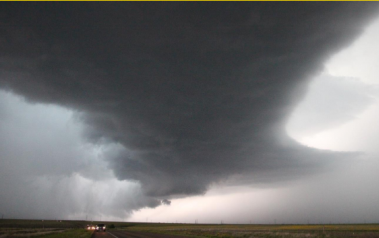
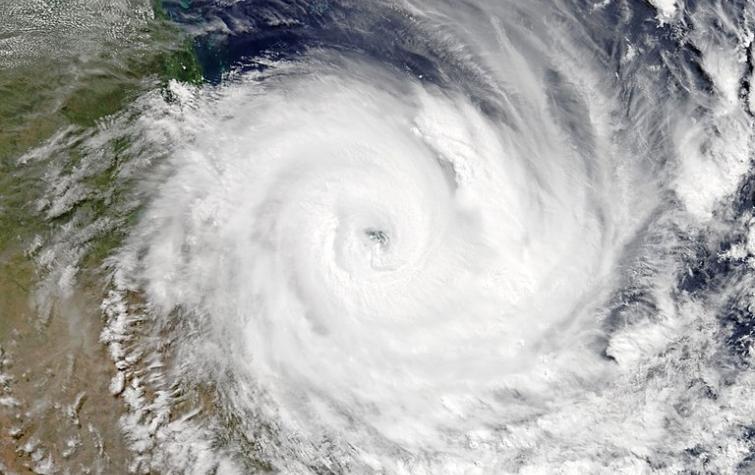
Recent tropical cyclone work has focussed on the structure of the boundary layer winds, especially the dynamics and characteristics of the low-level jet that is often found near the top of the boundary layer, and the factors that determine the strength of the surface winds relative to those aloft. The approach has been a mix of analytical modelling, numerical modelling, and the analysis of observations, including detailed case studies of the flow and balance in Hurricanes Georges and Mitch using data obtained by the NOAA Hurricane Research Division from the GPS dropsonde. These analyses required very accurate location of the cyclone centre, leading to the development of an objective new method for finding the centre of a storm using asynoptic mass data. Currently, I am attempting to better understand the turbulent structure of the tropical cyclone boundary layer, using dropsonde data .

Earlier work on air-sea interaction at high wind speeds included a demonstration of the roles of sea spray and rain evaporation in the thermodynamics of the TCBL, using a slab model which included parameterisations of these effects together with cloud downdrafts, clear sky and surface fluxes. I also used a turbulent closure model coupled to a spray dispersion and evaporation model to explore the transport and transformations of saline droplets in the full atmospheric boundary layer, and to refine bulk parameterisations of these effects. A major experimental project, instrumenting two 300 m towers on the tip of North West Cape, Western Australia, to make detailed boundary layer measurements during a tropical cyclone passage, ended in 2002.

Project leadership

This project is using high-resolution modelling, together with a range of meteorological data, to better understand and predict important meteorological natural hazards, including fire weather, tropical cyclones, severe thunderstorms and heavy rainfall. The outcomes from the project will contribute to reducing the impact and cost of these hazards on people, infrastructure, the economy and the environment.
Research team:
The project aimed to improve understanding of fire and atmosphere interactions and feedback processes through running the coupled fire-atmosphere model ACCESS-Fire. ACCESS-Fire is an important research tool and has the potential to be a critical operational tool. It will assist in informing fire management decisions as increasingly hazardous scenarios are faced in a changing climate. Further deliverables from the project include the preparation of meteorological and simulation case studies of significant fire events as publications, installation and testing of the ACCESS-Fire coupled model on the National Computing Infrastructure; and preparation of training material to support operational implementation of research findings. The project has demonstrably achieved the objective of building and sharing national capability in fire research and has provided fire and meteorology expertise during high impact events in support of end-users inside their operational centres.

Lead end user

This study is identifying the thresholds beyond which dynamic fire behaviour becomes a dominant factor, the effects that these dynamic effects have on the overall power output of a fire, and the impacts that such dynamic effects have on fire severity. This will necessarily include consideration of other factors such as how fine fuel moisture varies across a landscape. The research team is investigating the conditions and processes under which bushfire behaviour undergoes major transitions, including fire convection and plume dynamics, evaluating the consequences of eruptive fire behaviour (spotting, convection driven wind damage, rapid fire spread) and determining the combination of conditions for such behaviours to occur (unstable atmosphere, fuel properties and weather conditions).
Research team:
31 Aug 2020
Key findings: Our new method for calculating bushfire ember transport is accurateand very fast.
27 Aug 2019
To develop a pilot capability for making useful predictions of community impacts of extreme wind...
27 Aug 2019
In extreme cases, embers transported in a bushfire plume have started new fires over thirty...
27 Aug 2019
Pyrocumulonimbus (fire-induced thunderstorms, pyroCb) are associated with unpredictable changes in...
A case study of South Australia's severe thunderstorm and tornado outbreak (28 September 2016)
19 Sep 2018
One of the most significant thunderstorm outbreaks recorded in South Australia impacted central and...
Impact-based forecasting for the coastal zone
19 Sep 2018
Developing a pilot capability to estimate the impacts of East Coast Low hazards on the built...
Coupled fire-atmosphere simulations of the Sir Ivan Fire
19 Sep 2018
ACCESS-Fire couples an empirical fire spread model to the Australian numerical weather prediction...
Access-fire: Australia's coupled fire-atmosphere model
29 Jun 2017
Some bushfires exhibit extreme behaviour that exceeds the bounds of existing predictive guides....
Thermodynamics of pyrocumulus formation
29 Jun 2017
In favourable atmospheric conditions, large hot fires can produce pyrocumulus cloud: deep...
Ensemble prediction of the East Coast Low of April 2015
29 Jun 2017
Between 20-23 April 2015 the eastern coast of Australia was affected by a low-pressure system,...

Resources credited

Type Released Title Download Key Topics
Presentation-Slideshow 15 Sep 2020 France-Australia Workshop: Day 1/Panel 2 Jeff Kepert PDF icon Save (2.07 MB)
Presentation-Slideshow 27 Aug 2019 The PyroCb Firepower Threshold: A pyrocumulonimbus prediction tool PDF icon Save (9.16 MB) fire weather, severe weather
Presentation-Slideshow 27 Aug 2019 ACCESS-Fire PDF icon Save (11.32 MB) fire, modelling
Presentation-Slideshow 27 Aug 2019 A case study of South Australia's severe thunderstorm and tornado outbreak (28 September 2016) PDF icon Save (4.84 MB) communication, flood
Presentation-Slideshow 24 Aug 2019 Impact –Based Forecasting In The Coastal Zone: East Coast Lows PDF icon Save (2.37 MB) coastal, forecasting
Presentation-Slideshow 30 Jul 2019 ACCESS-Fire PDF icon Save (773.27 KB) fire, modelling
Presentation-Slideshow 30 Jul 2019 Improved predictions of severe weather to reduce community risk PDF icon Save (2.76 MB) communities, severe weather
Presentation-Slideshow 18 Jun 2019 Making better forecasts PDF icon Save (12.57 MB) communities, modelling, severe weather
Presentation-Slideshow 23 Nov 2018 Coupled fire-atmosphere modelling PDF icon Save (832.11 KB) fire, modelling
Presentation-Slideshow 23 Nov 2018 Improved predictions of severe weather to reduce community risk PDF icon Save (2.14 MB) communities, severe weather
Presentation-Slideshow 19 Sep 2018 The development of a pyrocumulonimbus prediction tool PDF icon Save (2.01 MB) fire impacts, fire severity
Presentation-Slideshow 18 Sep 2018 ACCESS-Fire to better understand risk PDF icon Save (1.81 MB) fire, modelling
HazardNoteEdition 14 Jun 2018 Extreme fire behaviour: reconstructing the Waroona fire pyrocumulonimbus and ember storms PDF icon Save (420.52 KB) fire impacts, fire severity, fire weather
Presentation-Slideshow 16 Apr 2018 Forecasting Impact for Severe Weather PDF icon Save (1.61 MB) coastal, forecasting, severe weather
Presentation-Audio-Video 05 Dec 2017 Lessons learned from the Waroona fire: AFAC webinar File Save (0 bytes) fire, fire weather, modelling
Presentation-Slideshow 31 Oct 2017 Impact forecasting: introducing a new project for 2017-19 PDF icon Save (1.13 MB) emergency management, forecasting, severe weather
Presentation-Slideshow 31 Oct 2017 Improved predictions of severe weather to reduce community impact PDF icon Save (1.93 MB) forecasting, mitigation, severe weather
Presentation-Slideshow 31 Oct 2017 Coupled fire-atmosphere modelling project: ACCESS-Fire PDF icon Save (580.38 KB) fire, fire weather, modelling
Presentation-Slideshow 07 Sep 2017 Secondary eyewall formation in tropical cyclones PDF icon Save (1.04 MB) cyclone, severe weather, tropical
Presentation-Slideshow 07 Sep 2017 Thermodynamics of pyrocumulus formation PDF icon Save (2.79 MB) fire, fire weather, severe weather
Presentation-Slideshow 07 Jul 2017 Building bushfire predictive services capability PDF icon Save (9.97 MB) fire, fire weather, modelling
Presentation-Slideshow 07 Jul 2017 Lightning presentation: improved predictions of severe weather PDF icon Save (2.59 MB) communication, fire weather, severe weather
HazardNoteEdition 12 Dec 2016 Fire escalation by downslope winds PDF icon Save (1.08 MB) fire impacts, fire severity, fire weather
HazardNoteEdition 28 Nov 2016 Monitoring and predicting natural hazards PDF icon Save (853.18 KB) forecasting, modelling, severe weather
HazardNoteEdition 25 Oct 2016 Next generation fire modelling PDF icon Save (1.35 MB) fire impacts, fire severity, fire weather
Presentation-Slideshow 24 Oct 2016 Coupled fire-atmosphere modelling project PDF icon Save (2.46 MB) fire severity, fire weather, modelling
Presentation-Slideshow 24 Oct 2016 Improved predictions of severe weather to reduce community risk PDF icon Save (9.18 MB) forecasting, modelling, severe weather
Presentation-Slideshow 30 Aug 2016 Why use ensemble prediction? - Jeff Kepert PDF icon Save (4.81 MB) fire weather, forecasting, severe weather
Presentation-Slideshow 30 Aug 2016 The effects of turbulent plume dynamics on long-range spotting - Will Thurston PDF icon Save (2.56 MB) fire, fire severity, fire weather
Presentation-Audio-Video 03 Apr 2016 Monitoring and prediction - cluster overview File Save (0 bytes) forecasting, multi-hazard, scenario analysis
Presentation-Slideshow 11 Sep 2015 Large-eddy simulations of pyro-convection and its sensitivity to environmental conditions PDF icon Save (1.24 MB) environments, fire weather, modelling
Presentation-Slideshow 02 Sep 2015 The Sydney 2014 Forecasting Demonstration Project A Step from Research to Operations PDF icon Save (1.27 MB) fire impacts, fire weather, severe weather
Presentation-Audio-Video 27 Oct 2014 The effects of fire-plume dynamics on the spread of long range spotting fire, modelling
22 Oct 2014 Managing severe weather: progress and opportunities forecasting, risk management, severe weather
Presentation-Audio-Video 20 Oct 2014 Managing severe weather - progress and opportunities risk management, severe weather
Presentation-Slideshow 08 Sep 2014 Modelling the fire weather of the Coonabarabran fire of 13 January 2013 PDF icon Save (10.08 MB) fire weather, modelling
Presentation-Slideshow 08 Sep 2014 The effects of fire plume dynamics on the lateral and longitudinal spread of long-range spotting PDF icon Save (2.25 MB) fire, fire impacts
Presentation-Slideshow 08 Sep 2014 Managing severe weather - progress and opportunities PDF icon Save (2.61 MB)
Presentation-Slideshow 21 Mar 2014 Improved predictions of severe weather to reduce community impact PDF icon Save (2.77 MB) risk management, severe weather, warnings

Send a message to Dr Jeff Kepert (via CRC)

User Contact