Marta Yebra

A/Prof Marta Yebra

Researcher
About
A/Prof Marta Yebra

A/Prof Marta Yebra is a Senior Scientist at the Centre for Water and Landscape Dynamics (Fenner School of Environment and Society) with a focus on using remote sensing data to monitor, quantify and forecast natural resources, natural hazards, and landscape function and health at local, regional and global scales. 

In 2017, Dr Yebra was awarded the prestigious Max Day Environmental Science Fellowship from the Australian Academy of Science. She was also awarded the CSIRO Pyne-Scott Career Award in 2013. 

Marta is an Associate editor for Remote Sensing of Environment (Elsevier), highest ranked journal in Earth observation for environmental applications (impact factor 6.265).

Project leadership

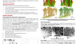
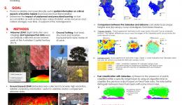
Over six years, the project used cutting-edge technology to produce near-real-time spatial information on fuel condition, fire hazard and impact to support a wide range of fire risk management and response activities such as hazard reduction burning and pre-positioning firefighting resources and, in the longer term, the new Australian Fire Danger Rating System. Based on the research findings, the researchers have produced the Australian Flammability Monitoring System, an interactive map of immediate fire danger associated with landscape dryness, which uses satellites to collect information about moisture content in trees, shrubs and grass, and assists with prescribed burning efforts and assessment of firefighting resources.
Research team:
Modelling Forest Fuel Temporal Change Using LiDAR
18 Aug 2015
The primary option available to reduce fire risks to the community and the environment is through a...
Mapping bushfire hazard and impact
25 Aug 2014
Little accurate and timely spatial information is currently available on bushfire hazard and...

Resources credited

Type Released Title Download Key Topics
HazardNoteEdition 22 Jan 2021 The Australian Flammability Monitoring System: providing a clear picture of landscape dryness PDF icon Save (768.18 KB) fire, fire impacts, remote sensing
Presentation-Audio-Video 26 Nov 2020 AFAC Webinar: Future of the Australian Flammability Monitoring System File Save (0 bytes) fire, fire impacts, remote sensing
Presentation-Slideshow 15 Sep 2020 France-Australia Workshop: Day 1/Panel 2 Marta Yebra PDF icon Save (2.57 MB)
Presentation-Slideshow 17 Oct 2019 Mapping bushfire hazard and impacts PDF icon Save (8.51 MB) fire, fire impacts, fire severity
Presentation-Slideshow 27 Aug 2019 Towards comprehensive characterisation of flammability and fire danger In the Australian Flammability Monitoring System PDF icon Save (3.57 MB) fire impacts, remote sensing
Presentation-Audio-Video 16 Aug 2019 The Australian Flammability Monitoring System File Save (0 bytes) fire, fire impacts, fire severity
29 Jul 2019 Remote sensing data with Dr Marta Yebra File Save (0 bytes) land management, remote sensing
Presentation-Slideshow 07 May 2019 Mapping bushfire hazard and impacts PDF icon Save (1.96 MB)
Presentation-Slideshow 23 Nov 2018 Mapping bushfire hazard and impacts PDF icon Save (5.9 MB) fire, fire impacts
Presentation-Slideshow 18 Sep 2018 A LiDAR-derived fuel map for the ACT PDF icon Save (1.88 MB) fire, modelling
Presentation-Slideshow 18 Sep 2018 Multi-temporal and spatial remote sensing imagery to monitor flammability in Australia PDF icon Save (3.56 MB) fire, fire impacts, modelling
Presentation-Audio-Video 03 Apr 2018 Australian Flammability Monitoring System: AFAC webinar File Save (0 bytes) fire, fire impacts
Presentation-Slideshow 31 Oct 2017 Mapping bushfire hazards and impacts: developing spatial information on fire hazard for planners, land managers and emergency services PDF icon Save (1.32 MB) fire, fire impacts, remote sensing
Presentation-Slideshow 07 Sep 2017 The Australian Flammability Monitoring System PDF icon Save (1.49 MB) fire, fire impacts, modelling
HazardNoteEdition 28 Nov 2016 Monitoring and predicting natural hazards PDF icon Save (853.18 KB) forecasting, modelling, severe weather
Presentation-Slideshow 24 Oct 2016 Mapping bushfire hazard and impact PDF icon Save (1.81 MB) fire impacts, modelling, remote sensing
Presentation-Slideshow 04 Dec 2014 Mapping bushfire hazard and impact PDF icon Save (1.44 MB) fire impacts, land management, planning
Presentation-Slideshow 21 Mar 2014 Monitoring and prediction PDF icon Save (7.35 MB) flood, modelling, multi-hazard

Send a message to A/Prof Marta Yebra (via CRC)

User Contact