hazard_reduction_burn_in_the_blue_mountains_2_may_2018._credit_nsw_npws.jpg

Research leader
Research team
End User representatives
Student researchers
Prescribed burning is a central feature of contemporary fire management, not just in Australia but in fire-prone countries around the world. Yet we lack a firm quantitative basis for understanding and comparing its effectiveness at mitigating risk across different regions. This project aimed to address these gaps and provide critical support to agency decision makers across southern Australia by undertaking a systematic investigation of the drivers of prescribed burning effectiveness across the region. This project is thus supporting fire managers in transitioning from hectare targets to a set of tailor-made, risk-based approaches.
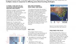
The key finding of the project is that the effectiveness of prescribed burning at mitigating area burnt by bushfire and other key values varies considerably across landscapes and values. That is, there is no one-size-fits-all solution to prescribed burning. This has major implications for fire managers, suggesting that tailored prescribed burning solutions are possible, based on the unique risk mitigation profile for any given suite of management values in that region. Further details are included in this report and journal articles listed herein.
While the project has been completed, its findings live on in the Prescribed Burning Atlas, a dedicated website for fire managers, researchers and anyone else interested in using our project to support their planning, decision making and communication. The Prescribed Burning Atlas will provide a geographically-based summary of risk for decision makers in an accessible, user friendly format. The Prescribed Burning Atlas provides quantitative risk-response relationships for prediction of the most probable outcome of different treatment strategies across varied bioregions. The Atlas has an interactive interface for end-users that allows them to explore not just these risk-response relationships, but also fuel accumulation and ignition probability models as well as projections of changes to risk under different climate, land use and management scenarios. The Atlas can be used in a range of ways, from strategic and tactical decision-making to policy development, resource allocation and education. Access the Atlas here https://prescribedburnatlas.science/


")


")