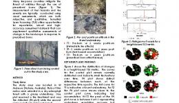
Dr Vaibhav Gupta’s PhD investigated the application of two emerging and independent terrestrial remote sensing technologies to ascertain burn severity of prescribed burns in dry sclerophyll forests of south east Australia. His research identified metrics derived from hyperspectral and terrestrial laser scanning data that best describe change produced in the landscape in response to the prescribed burns.
Vaibhav is now a remote sensing analyst at the NSW Department of Planning, Industry and Environment.
His thesis is available here.
Student project
Resources credited
| Type | Released | Title | Download | Key Topics |
|---|---|---|---|---|
| Presentation-Slideshow | 17 Oct 2019 | Fuels3D |
|
fire, fire impacts |
| HazardNoteEdition | 28 Nov 2016 | Monitoring and predicting natural hazards |
|
forecasting, modelling, severe weather |


