PUBLICATIONS
Published works

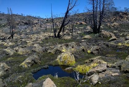
Post-fire impact assessment of Tasmanian sphagnum bogs
| Title | Post-fire impact assessment of Tasmanian sphagnum bogs |
| Publication Type | Report |
| Year of Publication | 2022 |
| Authors | Harding, M, Turner, D, Williamson, G, Nichols, S, Bowman, D |
| Document Number | 724 |
| Date Published | 03/2022 |
| Institution | Bushfire and Natural Hazards CRC |
| City | Melbourne |
| Report Number | 724 |
| Keywords | bogs, impact assessment, post-fire, sphagnum, Tasmanian |
| Abstract | In the summer of 2015-2016 several large dry lightning storms ignited wildfires that burned across Western Tasmanian landscapes desiccated by the combination of severe spring drought and above average summer temperatures. Approximately 20 000 ha of the Tasmanian Wilderness World Heritage Area burnt including Sphagnum moss communities, or ‘sphagnum bogs’, and other significant areas of high conservation value Gondwanan refugia. The scale of the fires prompted the Tasmanian government to fund research in techniques to rehabilitate fire-impacted Gondwanan refugia, including sphagnum bogs, in the Lake Mackenzie area of the Northern Central Plateau. A key step in sphagnum bog restoration is the development of rapid, broad-scale, cost-effective and low impact survey techniques to identify sites in need of rehabilitation. We trialled unmanned aerial systems (UAS) with visible spectrum sensor technology to map fire extent and severity. Three sphagnum bogs were used to develop an ENVI classification workflow based on a training data set of burn severity categories and other ecological surface cover measurements to map burn severity. These maps were validated using ocular assessments of ground cover and burn severity in pre-existing permanently marked quadrats. We found poor to moderate agreement between the UAS and field fire severity with considerable variation amongst the sampled bogs. Total burnt area sphagnum bog maps were then produced by combining burnt severity categories for five bogs, including the three used for fire severity mapping, The congruence between Sphagnum burn extent maps with field data collected by differential Global Positioning System was found to range from substantial to poor according to Cohen’s Kappa index. Multivariate analysis of the quadrat ground cover assessments showed that high grass cover was most strongly associated with poor field validation agreement (low Kappa scores), whereas acceptable field validation agreement (high Kappa scores), were associated with high cover of Sphagnum. A major constraint of this study was the two-year time gap between the fire and remote sensing mapping and field survey. Higher accuracy fire severity mapping and area burned mapping would be possible if imagery was acquired immediately after a fire event. In light of our findings, we provide recommendations for future UAS surveys of fire impacted sphagnum bogs, the most critical of which is acquiring remote sensing and field data in the same growing season as the fire. |
Published Works


