Image

As climate change drives longer and more intense bushfire seasons, the pressure is on to better predict and manage fire across Australia’s landscapes. At the heart of this challenge is a simple but critical question: how much fuel is on the ground and how likely is it to burn?
For years, land managers have relied on traditional visual assessments to measure fuel hazard—fine fuel such as dry leaves and undergrowth that can feed a fire. These methods have laid the foundation for understanding the fuel complex and assessing the likelihood of successful fire suppression, especially in challenging forest environments. Today, novel 3D remote sensing tools offer new opportunities to enhance and expand these insights.
Experts from the Office of Planetary Observations (OPO), supported by Natural Hazards Research Australia and the Department of Energy, Environment and Climate Action (DEECA), have improved the ability of land managers to interpret the detail captured in 3D data.
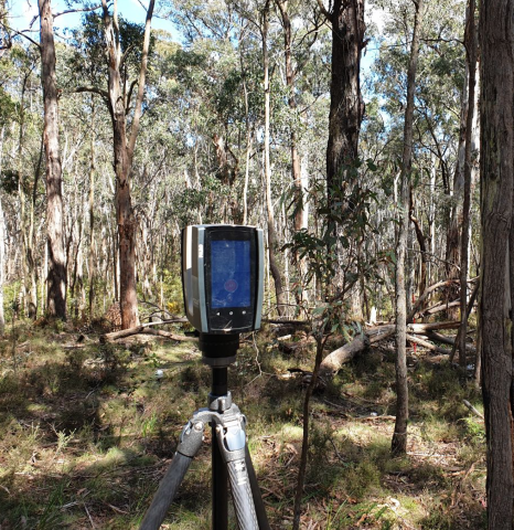
Victorian land and fire management agencies embraced the use of Terrestrial Laser Scanners to capture high-resolution 3D scans of forests, known as point clouds; however, the data remained largely underutilised.
OPO’s Lead Earth Scientist Luke Wallace and DEECA’s Sam Hillman say that the data and results are more reliable and will improve over time thanks to built-in annual updates.
"Australia has a proud legacy of fuel assessment, but the collection of 3D remote sensing data from the ground marks a step change—enabling repeatable, robust, and accurate insights into our landscapes like never before,” Sam explained. “Through this work, we’re making sure that all the rich detail captured in these scans can be put in the hands of fire and land managers to support safer landscapes for the community.”
“It’s a paradigm shift in how we measure and monitor bushfire risk, one laser scan at a time,” Luke said.
That’s where the Point Cloud Processing Hub project comes in.
The team of experts at Office of Planetary Observations, supported by Natural Hazards Research Australia and DEECA, established and expanded the capabilities of the Point Cloud Processing Hub. A digital tool designed to extract meaningful information from 3D forest scans. The team added new features that can automatically measure key fuel indicators, such as the number and size of trees in an area, and the vertical gap between ground-level plants and tree canopies, which are a crucial factor in how fires under the right conditions can transition from surface fires to rapidly spreading canopy fires.
The research team made it possible to link these detailed local measurements with satellite imagery, using artificial intelligence to scale up fuel insights across broader landscapes. Forest managers can now get a much clearer view of how fuel structure varies not just in one scan, but across regions.
Photo: Terrestrial laser scanning, Office of Planetary Observations
Better data leads to better decisions. When land managers have access to precise, up-to-date fuel information, they can implement more effective land and fire management practices. It’s a big step toward turning raw data into real-world action.
And the tool isn’t just sitting on a shelf. It’s already been put to use, with over 300 past 3D scans processed to improve fire hazard mapping across the state. With its new features and AI-powered capabilities, it’s ready to support ongoing research, long-term landscape monitoring and evidence-based policy.
As Australia faces a future of increasingly complex bushfire risks, projects like this show how technology and teamwork can help keep communities safer.
To receive further updates or for more information, contact Thomas Gooch, CEO, Office of Planetary Observations at thomas@opobservations.com.